Two Methods, One Goal
Both laser scanning and traditional tape survey produce the same end result — a set of accurate CAD drawings of an existing building. The difference is in how that data is collected, how accurate it is, and what you're left with at the end.
For simple, regular buildings, either method can produce perfectly adequate results. For complex, altered or high-value buildings, the difference is significant enough to matter to your project.
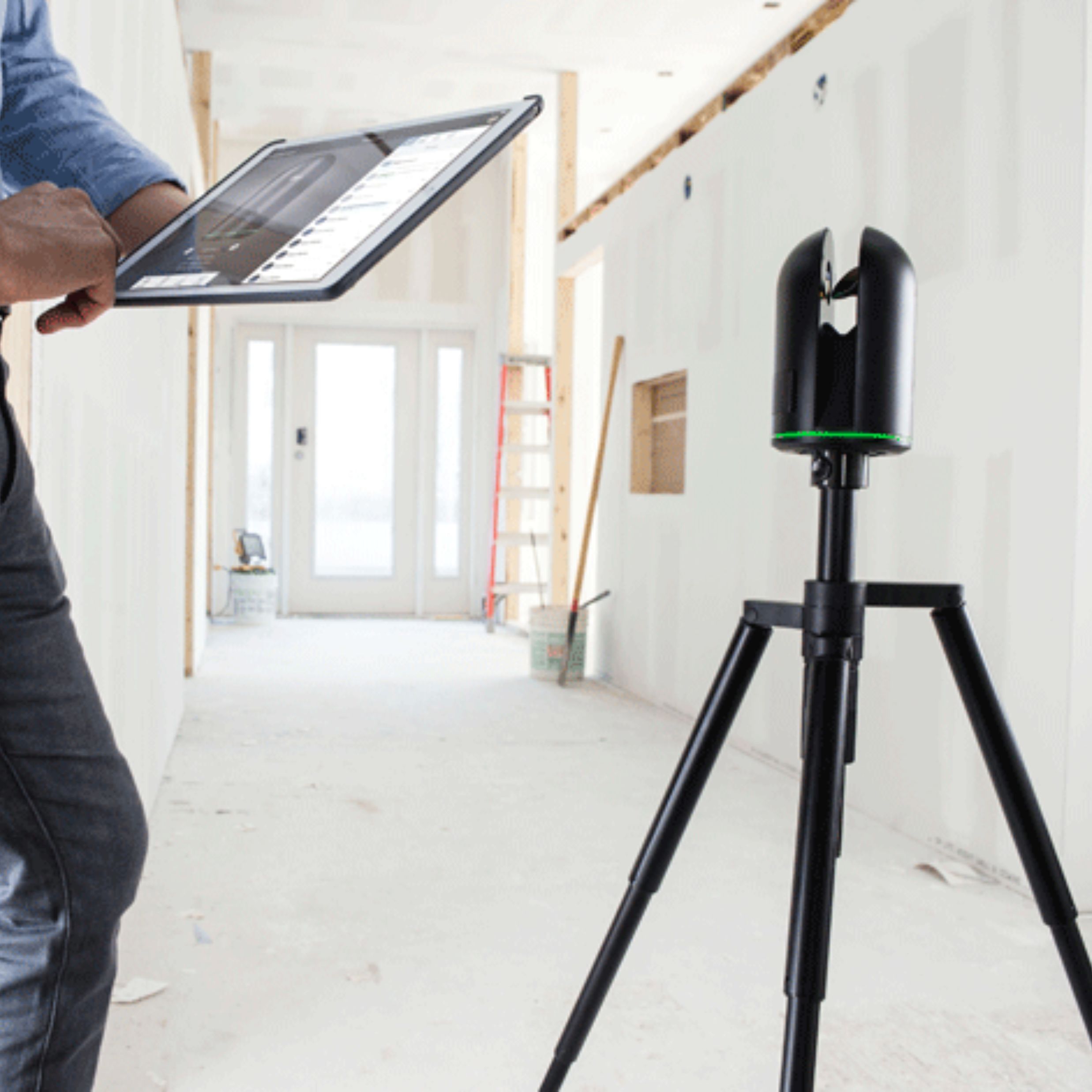
At SurveyX, we use the Leica BLK360 laser scanner on every project — the same equipment trusted by architects and engineers across the UK. The point cloud is included free with every scan.
The Traditional Tape Survey
A traditional measured survey uses a combination of tape measures and laser distance meters (disto) to record selected dimensions manually — room lengths and widths, ceiling heights, window and door positions, wall thicknesses and any other features specified in the brief.
On simple, regular buildings with straight walls and standard geometry, a skilled surveyor can produce accurate and reliable drawings using this method. It has been the industry standard for decades and remains valid for straightforward projects.

Where Traditional Survey Falls Short
The fundamental limitation of traditional survey is that it only records what the surveyor explicitly measures. On complex buildings — those with irregular geometry, curved walls, multiple split levels, ornate architectural detailing or significant alterations over time — this creates real risks:
- Features that weren't measured on site can't be added later without a return visit
- Errors accumulate across a building as measured dimensions are chained together
- Accuracy typically degrades to ±10–20mm on complex buildings
- Return visits add cost and delay to the project programme
3D Laser Scanning
A laser scanner works fundamentally differently. Rather than measuring selected points, it fires millions of laser pulses simultaneously in every direction, recording the exact 3D position of every surface it can see. A single scan position captures an entire room in 3–7 minutes — to sub-millimetre accuracy.
The result is a point cloud — a dense, complete 3D record of the building that can be measured, sectioned and referenced indefinitely. Nothing is missed because everything in the scanner's line of sight is captured automatically.

Accuracy: The Real Numbers
Accuracy is where the difference between the two methods becomes most significant on complex projects:
| Factor | Tape Survey | Laser Scanning |
|---|---|---|
| Point accuracy | ±2–5mm per measurement | ±4mm across entire building |
| Accumulated error | Increases across building | Consistent throughout |
| Complex geometry | Risk of missing features | Captured identically to flat walls |
| Return visits | Possible if gaps found | Never required |
| Permanent data | No — drawings only | Yes — point cloud kept indefinitely |

Which Method Is Right for Your Project?
The honest answer is that it depends on the building and the project:
Traditional Survey May Be Suitable If
- The building is simple and regular with straight walls and standard geometry
- The project is small in scope — a single room or straightforward flat
- Budget is the primary constraint and the risk of return visits is acceptable
Laser Scanning Is the Right Choice If
- The building has been extended or altered — irregular walls, varying floor levels
- The property is high-value and accuracy is critical throughout
- The project involves BIM modelling or the architect works in Revit
- Complex external elevations with ornate architectural detailing
- A permanent data record is needed for future reference
- Traditional survey records selected points — scanning records everything simultaneously
- Laser scanning achieves ±4mm accuracy consistently across the whole building
- The point cloud is a permanent data record — any dimension can be taken indefinitely
- For complex, altered or high-value buildings, scanning eliminates the risk of return visits
- The point cloud is included free with every SurveyX laser scanning survey
Every Building Deserves
Accurate Data.
We use the Leica BLK360 on every project — fixed price, 5–7 working day turnaround, UK wide.
Request a Free Quote